Ver categorias
Explorar
Fiverr Pro
Português
$
USD
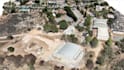
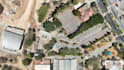
ESPECIALISTA EM ORTOMOZAICO, NUVEM DE PONTOS, MALHA 3D
Com uma base sólida em Engenharia Civil e uma paixão por inovação, eu me especializo em processamento de dados de drone, fotogrametria e modelagem 3D. Transformo imagens brutas de drone em ortomosaicos precisos, DSM/DTM, nuvens de pontos e malhas 3D, tudo georreferenciado e pronto para uso em GIS, CAD ou planejamento.
Minha expertise abrange modelagem de superfície a partir de DEMs, geração de KML/KMZ e criação de perfis para alinhamentos ou lotes, garantindo precisão e integração perfeita nos seus fluxos de trabalho de mapeamento ou visualização.
Processo:
Faça o upload dos seus dados de drone, eu processo com ferramentas avançadas de fotogrametria. Realizo verificações de qualidade. Compartilho uma prévia. Entrego os resultados finais de forma segura.
Entregas:
Orthomosaico (GeoTIFF/ECW)
DSM / DTM
Modelo 3D / Malha (OBJ / PLY)
Nuvem de pontos (LAS / XYZ)
KML / Contornos / Perfis
Exportações opcionais em DWG / DXF
Extras:
Mesclagem de vídeo de drone com locais marcados e perfilamento detalhado de superfície para uma visão mais completa do projeto.
Dados de drone rápidos, precisos e profissionais, entregues com exatidão.