Ver categorias
Explorar
Fiverr Pro
Português
$
USD

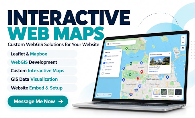
Need an interactive map that makes your locations, projects or GIS data easy to explore?
I build responsive WebGIS maps using Leaflet, Mapbox and OpenStreetMap for real estate, business, tourism, research and planning projects.
MY SERVICES
WHAT YOU WILL RECEIVE
WHY CHOOSE ME
From simple location maps to multi-layer GIS tools, I'll help you choose what fits.
Ready to make your data useful? Message me your project idea and files before ordering. Let's create a map your audience will enjoy using!
REMOTE SENSING AND GIS EXPERT
Idiomas
What type of interactive web maps can you create?
I create custom location maps, real estate maps, tourism maps, business location maps, GIS viewers and multi-layer WebGIS applications using tools such as Leaflet and Mapbox.
Which technologies do you use for web mapping?
I primarily work with Leaflet, Mapbox, JavaScript, HTML, CSS, OpenStreetMap and GIS tools such as QGIS. The technology depends on your project requirements.
Can you integrate an interactive map into my existing website?
Yes. I can provide an embeddable map or help integrate it into a compatible website. Please share your website platform before ordering so I can assess the integration requirements.
Can you use my GIS or geographical datasets?
Yes. I can work with GeoJSON, Shapefiles, KML, KMZ and CSV files. Data conversion or cleaning may be required depending on the file's condition and selected package.
Will my interactive map work on mobile devices?
Yes. All packages include responsive layouts designed for modern desktop, tablet and mobile browsers. Specific compatibility requirements should be discussed before ordering.
Can you add search, filters and clickable locations?
Absolutely. Search tools, attribute filters, popups, markers and layer controls are available according to your selected package and agreed scope.
What if I do not have GIS data for my project?
I can help identify suitable public datasets and discuss data preparation. Custom data sourcing, geocoding or extensive digitization may require an additional fee.
Do you provide the source code and map files?
Yes. You will receive organized project files, including the relevant source code and data files permitted for redistribution, together with basic setup guidance.
Do I need to purchase Mapbox, Google Maps or hosting services?
Not necessarily. Open-source mapping solutions are available. Some commercial mapping platforms, API features, or hosting providers have separate usage charges paid by the client.
Why should I contact you before placing an order?
Every interactive mapping project has different features, datasets and technical requirements. Contacting me first helps us agree on the appropriate package, cost and delivery timeline.