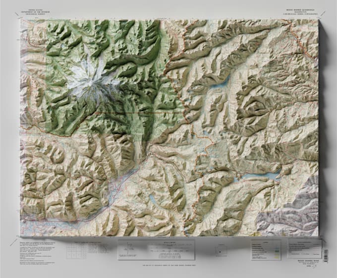
I will create vintage shaded relief topographic or satellite map

R
reliefmaps
R
reliefmaps
Fernando S

Level 1

Algumas informações são exibidas no idioma inglês.

Sobre este Serviço

WHAT WE OFFER IN THIS GIG


We create a vintage shaded relief map of the area of your choice using your National topo maps, the ones you provide, Hires Sat images or a custom made map


PACKAGES AVAILABLE


We provide three different packages:

  • Basic: One topo sheet area of the topo map, at 300 dpi to be printed at the same scale as the original map
  • Satnadard: You select and send us the area, and we will compose a full map


WHAT WE NEED


You need to provide the area you are looking for (for example a screenshot of the area from Google Maps). Would be useful to know also what kind of map you want (topographic, Sat image, city, custom map). Without the area we cant start work on it.


WHAT WE DELIVER


We deliver a tiff, psd, pdf of the map at 300 dpi to be printed

Preferência de estilo de entrega

Informe o freelancer sobre suas preferências ou preocupações em relação ao uso de ferramentas de IA na conclusão e/ou entrega de seu pedido.

Conheça mais sobre Fernando S

Fernando S
5,0(14)

Level 1

  • A partir deEspanha
  • Membro desdeabr. de 2025
  • Responde em aprox.:1 hora
  • Última entrega2 meses
  • Idiomas

    Espanhol, Inglês
I'm an experienced cartographer an graphic designer with more than 10 years experience in GIS, Cartography and specialised in magazine and book illustrations and custom Map making, Custom Maps Design, Maps Development, Google maps, Web Site Design and Development, Web Templates, Graphic Design Specialised in Illustrator, photoshop, Mapublisher (11.3), QGIS, ARCGIS, 3d printing of Maps, ... Blender 3D, among others Done maps & illustrations for History National Geographic Magazine, GEO, VIAJAR, History Revealed, among others