Ver categorias
Português
$
USD
Conecte-se à sua IA

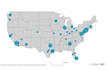
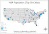
Raphael is pleased to deliver high-quality maps that meet your objectives through clear and precise data visualization technics. Over the years in the GIS and Remote Sensing industry, I have learned to understand my clients and offer the best out of their thoughts through advising on the best technics available to meet their goals. Communication brings about quality and efficiency, therefore, a client's willingness to share fully their expectations/objectives in the mapping and information analysis world is critical to both parties. As a result, I am more than willing to unleash my potential to meet your needs at the best level of engagement possible.
Furthermore, in this package, I will front my experience in making choropleth maps, study/location maps, heat maps, reference maps, and any other kind of maps that interest you.
Geospatial Data Specialist, GIS, Remote Sensing, Cartography, Trainer
Idiomas


