Ver categorias
Explorar
Fiverr Pro
Português
$
USD


Tradução automática
Olá
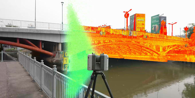
Sou especialista em processamento profissional de dados de nuvem de pontos de laser terrestre 3D e de drones, entregando conjuntos de dados limpos, otimizados e bem estruturados, prontos para Ambientes Autodesk ReCap e BIM.
Meu serviço foca em transformar dados brutos de scan em nuvens de pontos precisas e utilizáveis para AutoCAD, Revit, Civil 3D e outros softwares CAD e BIM. Seja sua origem de dados de laser scanners terrestres ou fotogrametria com drones UAV, eu cuido de toda a cadeia de processamento com precisão e cuidado.
Serviços incluídos:
Preparação de dados de nuvem de pontos para fluxos de trabalho BIM
Arquivos grandes são suportados, com transferência de arquivos segura via nuvem.
Se seu projeto possui requisitos técnicos específicos ou dados de scan em grande escala, sinta-se à vontade para entrar em contato. Ficarei feliz em revisar seus dados e oferecer uma solução confiável e eficiente, personalizada para seu projeto.
A Fiverr não seleciona freelancers nesta categoria. Favor verificar os requisitos de qualificação com o freelancer antes de realizar o pedido, incluindo as preferências em relação ao uso de ferramentas de IA.
Geomatics Expert
Idiomas
Tradução automática
Tradução automática
1. Com que tipo de dados de laser scan você trabalha?
Trabalho com nuvens de pontos de laser terrestre e LiDAR de sistemas como Leica, Trimble, FARO, entre outros, além de sistemas de LiDAR baseados em UAV.
2. Quais serviços estão incluídos no seu processamento de laser scan?
Serviços incluem registro de nuvem de pontos, alinhamento, remoção de ruído, limpeza, otimização e preparação para uso posterior em CAD ou BIM.
3. Você consegue registrar e alinhar múltiplas estações de scan?
Sim. Realizo registro e alinhamento precisos de múltiplos scans terrestres e conjuntos de dados de UAV LiDAR.
4. Você limpa ruídos como pessoas, veículos e objetos em movimento?
Sim. Removo pontos indesejados, incluindo pessoas, veículos, ruído de vegetação, reflexões e artefatos de scan.
5. Quais formatos de arquivo você aceita e entrega?
Suporto formatos comuns de nuvem de pontos como E57, LAS, LAZ, PTS, PTX, XYZ, FLS, TZF, RCP e outros.
6. Você cria projetos no Autodesk ReCap?
Sim. Posso entregar projetos bem estruturados no Autodesk ReCap, com scans organizados e desempenho otimizado.
7. Você consegue lidar com conjuntos de dados de scan grandes ou complexos?
Sim. Trabalho regularmente com projetos de grande escala, incluindo sites industriais, infraestrutura e varreduras de terreno.
8. Como você transfere arquivos grandes de nuvem de pontos?
Transferência segura via nuvem está disponível por meio de Google Drive, Dropbox, OneDrive ou outras plataformas conforme necessário.
9. Suas nuvens de pontos estão prontas para uso por equipes de CAD ou BIM?
Sim. Embora eu não crie modelos, as nuvens de pontos processadas estão limpas, alinhadas e prontas para fluxos de trabalho CAD ou BIM.
10. Devo te contatar antes de fazer o pedido?
Sim. Por favor, entre em contato primeiro para que eu possa revisar seus dados de scan e confirmar o melhor fluxo de trabalho para seu projeto.