Serviços de IA
Publique seu livro
Crie seu site
Crie sua marca
Aumente seu público
Logotipo e Identidade de Marca
Arte e Ilustração
Diversos
Design de Aplicativos e Web
Produto e Games
Design de Impressão
Livros e E-books
Design Visual
Design de Marketing
Moda e Mercadorias
Design 3D
Encontre animadores, designers, editores de vídeo, dubladores e muito mais.
Nuvem e Cibersecurity
Encontre desenvolvedores de aplicativos, web designers, especialistas em IA e muito mais.
Social
Específico para Canais
Métodos e Técnicas
Analytics e Estratégia
Impulsione Seu Marketing com IA
Indústrias e Fins Específicos
Encontre especialistas em SEO, profissionais de marketing digital, especialistas em vendas, gerentes de mídia social e muito mais.
Edição e Pós-Produção
Vídeos de Marketing e Mídia Social
Vídeos com Apresentador
Design de Animação
Animação
Produção de Filmagens
Vídeos Explicativos
Vídeos de Produtos
Redação de Conteúdo
Edição e Crítica
Publicação de Livros e E-books
Redação para Carreira
Redação para Negócios e Marketing
Tradução e Transcrição
Conteúdo de Setor EspecíficoNovo
Encontre redatores, criadores de conteúdo, revisores, tradutores e muito mais.
Engenharia de Áudio e Pós-Produção
Streaming e Áudio
Serviços de DJ
Design de Som
Aulas e Transcrições
Formação de Empresa e Consultoria
Operações e Gerenciamento
Vendas e Atendimento ao Cliente
Encontre contadores, advogados, gerentes de projeto e muito mais.
Desenvolvimento de IA para Dispositivos Móveis
Dados
Artistas de IA
IA para Empresas
Áudio com IA
Conteúdo de IA
Aperfeiçoamento Pessoal
Moda e Estilo
Lazer e Hobbies
Bem-estar e Fitness
Consultores de Negócios
Estratégia de Marketing
Consultoria de Dados
Coaching e Orientação
Consultoria de Tecnologia
Mentoria
Análise e Visualização de Dados
Coleta de Dados
Gerenciamento de Dados
Banco de Dados e Engenharia
Produtos e Lifestyle
Pessoas e Cenas
Fotografia Local
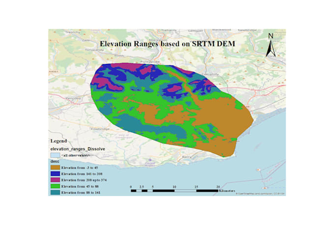
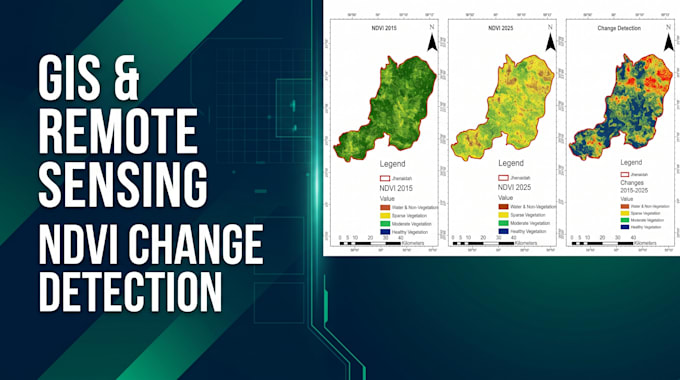
GIS an Data Visualization Expert
Habilidades
+6
Conheça meus serviços
Mostrar todos (3)
Enviar mensagem para Sakawat Hossain