n
nadiaikram

Nadia

@nadiaikram
4,7(26)

Level 2

GIS Analyst, Mapping, Spatial Analysis and Data Visualization

Paquistão
Inglês, Francês, Espanhol, Alemão
Algumas informações são exibidas no idioma inglês.
Sobre mim
Hi there, I’m Nadia, a GIS Analyst and Remote Sensing Specialist with 4+ years of experience. I help clients with GIS mapping, spatial analysis, digitizing, cartography, land use/land cover mapping, remote sensing, georeferencing, and data visualization. I work with ArcGIS Pro, QGIS, Google Earth Pro, Google Earth Engine, and SNAP. I have worked on projects related to environmental management, urban planning, agriculture, and land-use mapping. My goal is to make GIS work simple, reliable, and useful for every client. If you have a GIS or mapping project, feel free to contact me!📩... Saiba mais

Habilidades

n
nadiaikram
Nadia
US$ 12/hora
offline • 
Tempo médio de resposta: 1 hora

Conheça meus serviços

Sistemas de Informação Geográfica
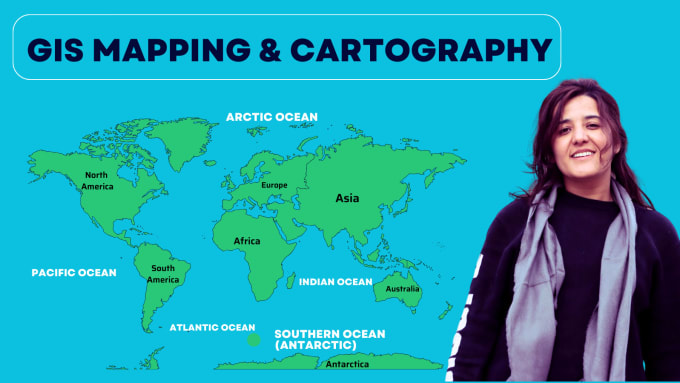
I will provide you professional gis maps, cartographic and topographic maps
4,7(17)
Sistemas de Informação Geográfica
I will be your geospatial analyst, cartographer and gis mapping specialist
5,0(5)

Quer trabalhar com remuneração por hora?

Diga a Nadia o que você precisa.

US$ 12

/

hora

Portfólio

Experiência profissional

Fiverr

Gis Analyst | Data Visualization expert

Fiverr • Freelance

Sep 2023 - Present • 3 yrs 2 mos

I am working as a GIS Analyst and Data Visualization Expert on Fiverr, providing GIS mapping, spatial analysis, remote sensing, and data visualization services. I have over 4 years of experience using ArcGIS Pro, ArcMap, QGIS, and Google Earth Pro to create accurate maps, analyze spatial data, and turn complex information into clear and meaningful visuals. I work with clients on projects related to land use, environmental management, urban planning, and agriculture.

Gis Analyst

theinnoventures.pvt.ltd • Período integral

Dec 2023 - Sep 2024 • 9 mos

I worked as a GIS Analyst at Innoventures Pvt. Ltd., where I gained practical experience in Geographic Information Systems (GIS) and Remote Sensing (RS). During my time there, I worked on different GIS-based projects that involved analyzing spatial data, creating maps, and processing satellite imagery. I used GIS software such as QGIS to organize and visualize geographic data and support different types of analysis. Through this experience, I improved my skills in spatial data management, map creation, and satellite image interpretation. It also helped me understand how GIS can be used to solve real-world problems and support better decision-making in areas such as environmental analysis, planning, and mapping

26 Avaliações
4,7

(20)
(3)
(0)
(1)
(2)
Classificação detalhada
  • Nível de comunicação do freelancer
    4,8
  • Qualidade da entrega
    4,7
  • Valor da entrega
    4,7
1-5 fora das 26 avaliações
Ordenar por
Mais relevante
    K

    ken96734

    US

    Estados Unidos

    Colaboração contínua
    4,3

    Nadia was doing a very good job of working with poor documents from me and was able to make it into the working documents i need

    US$ 100-US$ 200

    $

    1 dia

    Tempo

    gig

    Sistemas de Informação Geográfica

    Útil?
    Sim
    Não
    K

    ken96734

    US

    Estados Unidos

    Colaboração contínua
    5

    Nadia did a great job as always

    US$ 50-US$ 100

    $

    4 dias

    Tempo

    gig

    Sistemas de Informação Geográfica

    Útil?
    Sim
    Não
    K

    ken96734

    US

    Estados Unidos

    Colaboração contínua
    5

    Nadia does good work

    US$ 100-US$ 200

    $

    1 dia

    Tempo

    gig

    Sistemas de Informação Geográfica

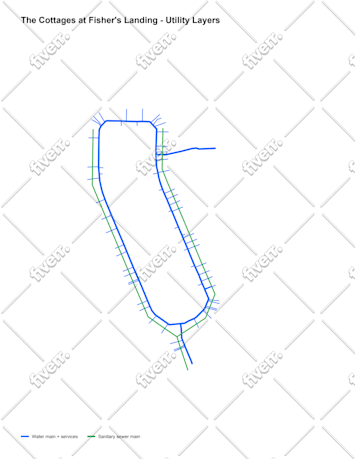
    Imagem de amostra
    Útil?
    Sim
    Não
    S

    sandrawagner106

    US

    Estados Unidos

    5

    very good job, professional and competent.

    US$ 100-US$ 200

    $

    8 dias

    Tempo

    gig

    Sistemas de Informação Geográfica

    Útil?
    Sim
    Não
    I

    ivvvanguetler

    CH

    Suíça

    2,3

    it just did not match.

    US$ 50-US$ 100

    $

    8 dias

    Tempo

    gig

    Sistemas de Informação Geográfica

    Útil?
    Sim
    Não