Vou desenhar mapas, mapas do arcgis e projetos de gis

M
mutemit
M
mutemit
Titus Mutemi
Algumas informações foram traduzidas automaticamente.

Sobre este Serviço

Tradução automática

Olá...

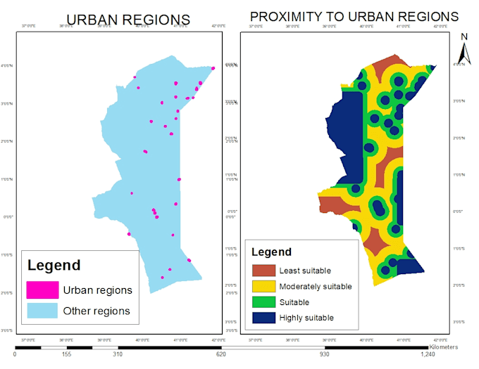
Eu desenho mapas topográficos, mapas analíticos, análise espacial e todos os projetos do ArcGIS.

Crio DEMs a partir do Google Earth, contornos e mapas de localidade.

Uso imagens de satélite para fazer classificação usando Erdas Imagine e ArcGIS.

Conheça mais sobre Titus Mutemi

Titus Mutemi

Geomatics Engineer,GIS Analyst

  • A partir deQuênia
  • Membro desdedez. de 2022
  • Idiomas

    Inglês
Hello there..I am a trained Surveyor and GIS(Geographic Information Systems) Analyst. I hold a bachelors degree in Geomatics Engineering and GIS & Remote Sensing. I have a 6 years experience in this field and expert in using various GIS software including QGIS, ArcGIS, Global Mapper, Google Earth and related. Survey software; AutoCAD, Civil 3D. Remote Sensing software; Envi and Erdas Imagine.

Tradução automática