Ver categorias
Explorar
Fiverr Pro
Português
$
USD
Sou um Analista de Sensoriamento Remoto & GIS (BS Ciências Espaciais) com experiência prática em mapeamento de risco de desastre, monitoramento ambiental e análise espacial baseada em satélite, atualmente atuando profissionalmente em agri-tech e consultoria geoespacial.
Entrego análises GIS e mapas de qualidade para publicação para aplicações de pesquisa, gerenciamento de desastres, ambientais e agrícolas, usando ArcGIS Pro, QGIS, Google Earth Engine e Python (geopandas, rasterio e GDAL).
O que posso entregar:
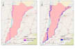
Aplicuei esse trabalho em pesquisas reais de risco de desastre (estudo de susceptibilidade a enchentes no sul de Punjab, ROC-AUC > 0,90, preparado para submissão em revista) e projetos operacionais de monitoramento de seca/LULC.
https://portfolio-sarfarz.netlify.app/

Tradução automática
O que você precisa de mim para começar?
Área de estudo (shapefile/KML, coordenadas ou nome do distrito/região) Tipo de análise necessária (enchente, seca, uso do solo, água subterrânea, etc.) Período de tempo (uma única data ou detecção de mudanças ao longo de vários anos) Propósito (tese, relatório, planejamento de desastre, publicação) — ajuda a eu ajustar o estilo do resultado