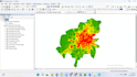
I will do gis mapping and remote sensing analysis

M
moizkhan300
M
moizkhan300
Moiz Ahmed khan
Algumas informações são exibidas no idioma inglês.

Sobre este Serviço

I am a Water Resources Engineer with expertise in Remote Sensing and GIS. My services include:

  • Spatial data analysis and mapping using ArcGIS
  • Watershed and catchment analysis for hydrology and flood management
  • Flood risk and inundation mapping
  • Integration of remote sensing data for monitoring and planning
  • Preparation of high-quality GIS maps, technical reports, and spatial datasets

I deliver accurate, actionable, and standards-compliant GIS solutions to support water resource management, urban planning, and environmental projects.

Preferência de estilo de entrega

Informe o freelancer sobre suas preferências ou preocupações em relação ao uso de ferramentas de IA na conclusão e/ou entrega de seu pedido.

Conheça mais sobre Moiz Ahmed khan

Moiz Ahmed khan

Water Resources Engineer

5,0(1)
  • A partir dePaquistão
  • Membro desdejan. de 2019
  • Responde em aprox.:1 hora
  • Última entrega4 semanas
  • Idiomas

    Inglês
I am a Water Resources Engineer with an MS in Water Resources Engineering from UET Lahore, offering professional services in hydrology, hydraulics, and water infrastructure design. My expertise includes hydrological and hydraulic modeling, flood hazard and risk analysis, pipe network design, and drainage and sewerage system design. I work with industry-standard tools such as HEC-HMS, HEC-RAS (1D & 2D), ArcGIS, AutoCAD/Civil 3D, SewerGEMS, WaterGEMS, and WaterCAD to deliver accurate, reliable, and standards-compliant results.

Meu portfólio