m
mandidabdo

Mandid

@mandidabdo

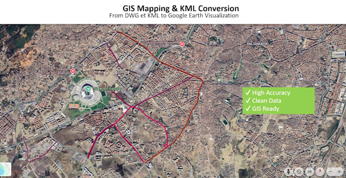
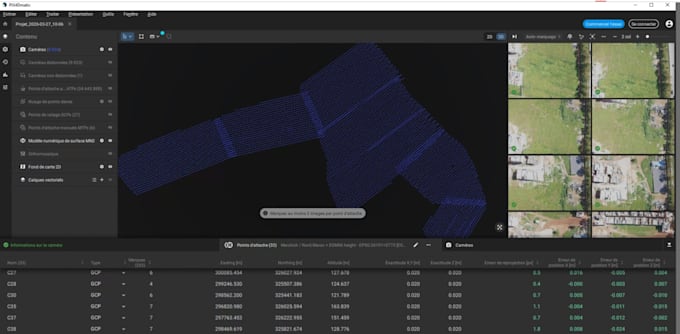
Topographic Engineer GIS and AutoCAD Expert Drone Image Processing Pix4Dmati

Marrocos
Inglês, Francês, Árabe
Algumas informações são exibidas no idioma inglês.
Sobre mim
I am a professional Topographic Engineer and GIS specialist with strong experience in surveying, AutoCAD drafting, geospatial data processing, and drone image processing using Pix4Dmatic. I provide accurate and high-quality services including: - Topographic plans (DWG, PDF) - GIS mapping and spatial analysis - Parcel and cadastral mapping - Drone and LiDAR data processing (point cloud processing) - Orthophoto generation and photogrammetry - KML/KMZ creation and Google Earth mapping I am committed to delivering precise results, fast turnaround, and professional communication.... Saiba mais

Habilidades

m
mandidabdo
Mandid
offline • 
Tempo médio de resposta: 1 hora

Conheça meus serviços

Consultoria
I will create topographic maps, gis mapping and autocad plans
Consultoria
I will process drone images using pix4dor mati agisoft metashape

Experiência profissional

Freelancer.com

Freelance Topographic Engineer

Freelancer.com • Freelance

Jan 2013 - Present13 yrs 4 mos

Providing freelance services in topographic surveying, GIS mapping, and geospatial data processing. - Topographic plans (DWG, PDF) - GIS mapping and spatial analysis - Drone data processing and orthophoto generation (Pix4Dmatic) - LiDAR and point cloud processing - Parcel and cadastral mapping