Ver categorias
Explorar
Fiverr Pro
Português
$
USD
Não sou recluso, só sou reservado
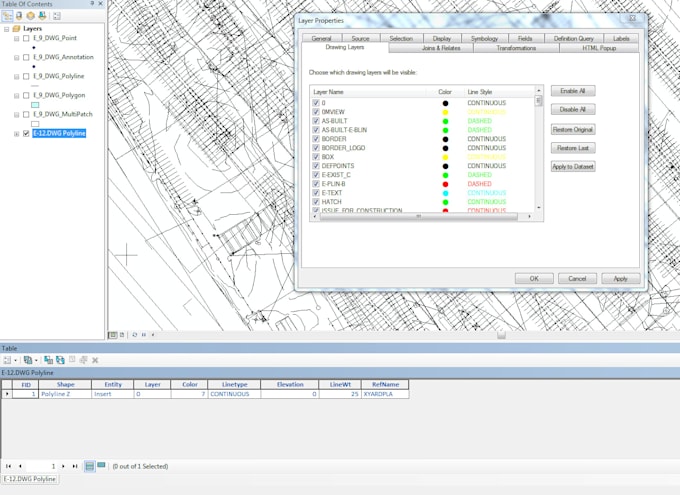
Especialista em conversão de CAD para GIS
Converter desenhos do AutoCAD para dados GIS georreferenciados com precisão e exatidão.
️ Serviços:
- DWG/DXF para Shapefile
- Georreferenciamento de arquivos CAD
- Transformação de sistema de coordenadas
- Transferência de dados de atributos
- Criação de topologia
- Controle de qualidade e validação
Formatos de entrada:
DWG | DXF | DGN | mapas em PDF
Formatos de saída:
Shapefile | GeoJSON | KML | FileGDB | PostGIS
Perfeito para empresas de engenharia, prefeituras, utilities, construtoras, topógrafos.
Conversões precisas com sistemas de coordenadas adequados!