Ver categorias
Explorar
Fiverr Pro
Português
$
USD
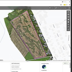
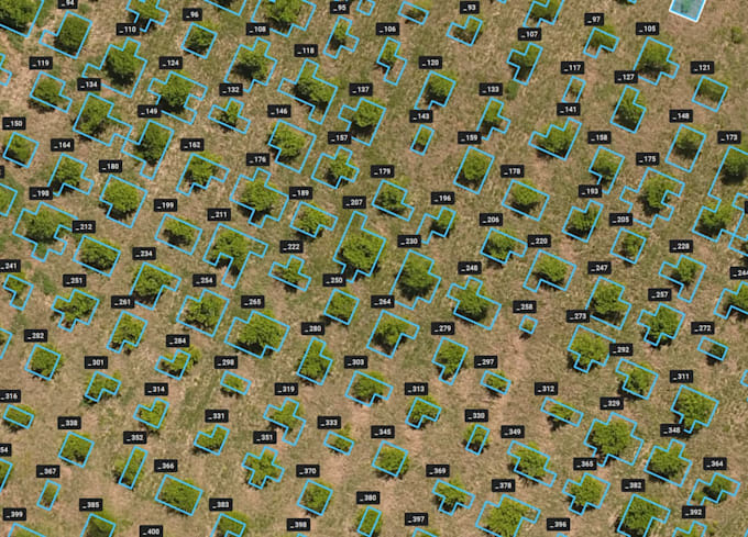
Precision GIS mapping and operational drone data processing
Habilidades
Conheça meus serviços
GIS & CAD Data Specialist
Agrobiz Solutions • Freelance
Feb 2022 - Jun 2026 • 4 yrs 4 mos
I specialize in geographic information systems, digital mapping, and precision agriculture data processing. My work involves creating highly accurate operational flight maps for drones, digitizing field boundaries, and setting up precise obstacle zones. I possess expert skills in vectorizing land plots and engineering sketches using specialized software. Additionally, I manage 2D drafting processes in AutoCAD, ensuring technical accuracy, clear layer structures, and strict compliance with project deadlines.
