Ver categorias
Explorar
Fiverr Pro
Português
$
USD

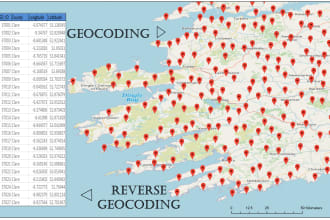
GIS,Data Analyst
Habilidades
Conheça meus serviços

Quer trabalhar com remuneração por hora?
Diga a Muhammad S. o que você precisa.
US$ 9
/
horaGIS Analyst
Planning and Development, Government of Khyber Pakhtunkhwa, Pakistan • Período integral
Oct 2020 - Present • 5 yrs 8 mos
Responsible for geospatial mapping and data entry for the Annual Development Programme (ADP) on the Web GIS Portal and conduct field verification of Annual Developmental Schemes upon instruction from the Deputy Commissioner. In charge of mapping district jurisdictional boundaries, including District, Tehsil, UC, and NCVC. Offer technical support to line departments for GIS data collection and map creation. Manage the mapping of public facilities across sectors like Education, Health, State Land, Public Health Engineering, Population Welfare, Irrigation, Food, Wildlife, Livestock, Rescue, and Auqaf. Utilize GIS mapping to enable rapid visualization of affected areas and infrastructure damage during emergencies, including COVID-19, floods, GLOF events, earthquakes, road blockages, and landslides. Manage the mapping of ground features, including roads, rivers, streams, agricultural land, and settlements, for suitability analysis and decision-making
| (31) | ||
| (4) | ||
| (1) | ||
| (0) | ||
| (0) |

chefannam

Estados Unidos
Muhammad S. provided me with the specific addresses from a neighborhood I was in need of for my business mailing. We did need to revisit my main request several times but in the end I believe I got what I was needing and he was very pleasant and respectful. I will work with him again in the future. Thanks for taking pride in your work!
Resposta do freelancer
mo7amd_98

Emirados Árabes Unidos
Resposta do freelancer

mjdominus
Estados Unidos
Working with Shoaib was very smooth. He did the work overnight for a good price and delivered what I needed. He answered all my questions immediately. I would work with him again.
Resposta do freelancer
yk_cas

Taiwan
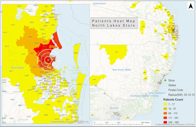
Excellent work! Shoaib quickly created the heat map from my zip code population data in polygon format. I am really impressed by his mapping skills and prompt response. He is very professional, delivered the job before time, and at a reasonable price. I'd love to work with him again.
Resposta do freelancer
realestate99999

Arábia Saudita
fast, nice, deliverable, avaliable, and fair price
Resposta do freelancer