g
geospatial_engr

Geospatial

@geospatial_engr
4,9(60)

Level 2

Pro Experts in GIS, Mapping, 3D Models, Drones, and Civil Engineering

Paquistão
Inglês
Algumas informações são exibidas no idioma inglês.
Sobre mim
I offer professional services in GIS, mapping, geospatial analysis, 3D modeling, land surveying, topographic contours, digital elevation models, drone photogrammetry, flood modeling, and civil engineering services, including site plans and design. From satellite image analysis to Google Earth flythroughs, interactive web map applications, and CAD drawings, we deliver customized solutions, for large-scale projects and individual property needs. I am committed to accuracy, fast delivery, and client satisfaction. Feel free to inbox before placing your order!... Saiba mais

Habilidades

g
geospatial_engr
Geospatial
US$ 30/hora
offline • 
Tempo médio de resposta: 1 hora

Conheça meus serviços

Sistemas de Informação Geográfica
I will create accurate digital elevation models, dem, dsm, dtm, contours, and gis maps
4,9(16)
Desenhos 2D e Plantas Baixas
I will create contour map and topographic plan using survey or gis data
4,8(16)

Quer trabalhar com remuneração por hora?

Diga a Geospatial o que você precisa.

US$ 30

/

hora

Portfólio

60 Avaliações
4,9

(56)
(4)
(0)
(0)
(0)
Classificação detalhada
  • Nível de comunicação do freelancer
    4,9
  • Qualidade da entrega
    4,8
  • Valor da entrega
    4,8
1-5 fora das 60 avaliações
Ordenar por
Mais relevante
    B

    bleblanc03

    US

    Estados Unidos

    5

    Great to work with. Delivered nice assets for my project. I would not hesitate to reach out again if/when I need more work at this level.

    US$ 400-US$ 600

    $

    3 semanas

    Tempo

    gig

    Sistemas de Informação Geográfica

    Imagem de amostra
    Útil?
    Sim
    Não
    L
    image-docs

    lynntaylor

    US

    Estados Unidos

    4

    Thank you!!!!!!!!!!!!!!!!!!!!!

    US$ 50-US$ 100

    $

    5 dias

    Tempo

    gig

    Desenhos 2D e Plantas Baixas

    Útil?
    Sim
    Não
    J

    jebjeb2000

    US

    Estados Unidos

    4,3

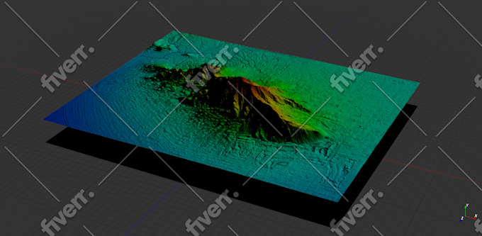
    I needed a model of a mountain for architectural rendering. Geospatial provided a highly detailed file that was actually far too large for my program to handle. Geospatial followed up with several options of smaller size, and I was able to use the edits. They were communicative in adjusting the parameters to fit what I needed. Thank you!

    US$ 100-US$ 200

    $

    2 semanas

    Tempo

    gig

    Sistemas de Informação Geográfica

    Imagem de amostra
    Útil?
    Sim
    Não
    J

    jasonwarner845

    Cliente recorrente

    CR

    Costa Rica

    5

    Thank you once again.

    US$ 50-US$ 100

    $

    4 dias

    Tempo

    gig

    Sistemas de Informação Geográfica

    Útil?
    Sim
    Não
    J

    jasonwarner845

    Cliente recorrente

    CR

    Costa Rica

    5

    Thank you once again.

    Até US$ 50

    $

    6 dias

    Tempo

    gig

    Sistemas de Informação Geográfica

    Útil?
    Sim
    Não