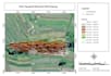
Criar mapas profissionais de GIS e visualizações de dados geoespaciais
D
D
David B
Algumas informações foram traduzidas automaticamente.
Tela Inteira
Tela Inteira
Visualizar Apresentação
Sobre este Serviço
Tradução automática
Vou criar mapas profissionais de GIS, realizar análises espaciais e visualizar dados geoespaciais usando ArcGIS, QGIS e outras ferramentas de GIS. Posso ajudar você a transformar dados geográficos em mapas claros, precisos e visualmente atraentes para seus projetos.
Ferramenta
ArcGIS
Conheça mais sobre David B
David B
Senior Staff Operational
A partir deIndonésia
Membro desdemar. de 2026
Responde em aprox.:1 hora
Idiomas
Indonésio, Inglês
Master’s degree in Geomatic Engineering (ITS) with strong specialization in GIS and Remote Sensing
Research and technical expertise in machine learning for geospatial analysis (XGBoost)
Over four years of experience in GIS applications for infrastructure and environmental projects
Advanced proficiency in ArcGIS, QGIS, geodatabase management, and spatial analysis tools
Strong background in topographic surveying, data processing, and engineering integration
A proven ability to collaborate with multidisciplinary teams and government institutions