Ver categorias
Explorar
Fiverr Pro
Português
$
USD


Tradução automática
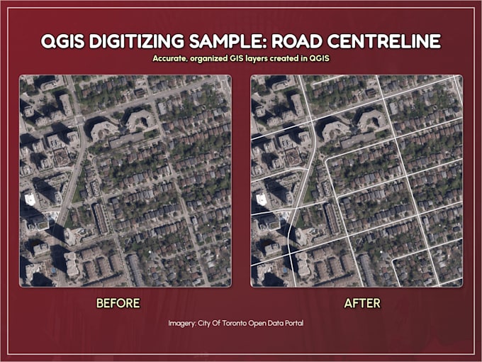
Converta PDFs, CADs ou mapas de imagens em camadas GIS limpas e organizadas.
Eu digitalizo pontos, linhas e polígonos no QGIS e entrego saídas estruturadas em Shapefile, GeoJSON, KML ou GeoPackage prontas para uso no ArcGIS, QGIS, uMap ou Google Earth.
Com mais de 10 anos de experiência em GIS, foco em topologia limpa, atributos consistentes e precisão prática na cartografia.
Escopo & Complexidade
Os pacotes incluem recursos simples com contagem moderada de vértices. Limites altamente detalhados (por exemplo, linhas de contorno, zonas climáticas, regiões baseadas em terreno, camadas CAD densas ou desenhos de engenharia irregulares) requerem uma cotação personalizada. Por favor, envie uma mensagem antes de fazer o pedido para mapas complexos.
Georreferenciamento de PDFs escaneados ou não espaciais está disponível como complemento.
Revisões cobrem pequenas correções nas características originalmente especificadas. Novas características ou mudanças no escopo requerem uma oferta personalizada.
Entregas:
Os resultados são adequados para mapeamento e análise geral (não para uso em levantamento ou limites legais).
GIS Analysis and Visualization
Idiomas
Tradução automática
Tradução automática
O que conta como uma feature?
Uma feature é um ponto, linha ou polígono simples com complexidade moderada de vértices. Formas altamente detalhadas (por exemplo, linhas de contorno, regiões de terreno, camadas densas de CAD) podem precisar de uma oferta personalizada.
Você faz georreferenciamento de PDFs escaneados ou não espaciais?
Sim, como um complemento. Por favor, confirme se seu mapa fonte já está georreferenciado antes de fazer o pedido.
O que está incluído em uma revisão?
Revisões cobrem pequenas correções nas features originalmente especificadas. Novas features ou escopo expandido requerem uma oferta personalizada.
Devo enviar uma mensagem para você antes de fazer o pedido?
Sim, especialmente para mapas complexos, desenhos de engenharia, mapas de contorno ou grandes conjuntos de dados. Uma mensagem rápida garante preços e prazos precisos.
Isso é adequado para uso legal ou de levantamento?
Não. Os entregáveis são destinados exclusivamente para mapeamento e análise geral.
| (2) | ||
| (0) | ||
| (0) | ||
| (0) | ||
| (0) |
cottage_farm

Estados Unidos
Chris handled exceptionally well an assignment that involved overlaying present-day streets and property parcels on to a 1774 map of the same area. This involved combining his expert knowledge of GIS and data visualization with strong approaches to making the final product legible and attractive. All...
US$ 100-US$ 200
$
8 dias
Tempo
nnijinsky

Canadá
Cjhoorn did an outstanding job on my request. The work was precise, well-structured, and delivered on time, with excellent communication throughout. I highly recommend Cjhoorn for any GIS/KMZ mapping tasks.
US$ 50
$
3 dias
Tempo
| (2) | ||
| (0) | ||
| (0) | ||
| (0) | ||
| (0) |
cottage_farm
Estados Unidos
Chris handled exceptionally well an assignment that involved overlaying present-day streets and property parcels on to a 1774 map of the same area. This involved combining his expert knowledge of GIS and data visualization with strong approaches to making the final product legible and attractive. All...
US$ 100-US$ 200
$
8 dias
Tempo
nnijinsky
Canadá
Cjhoorn did an outstanding job on my request. The work was precise, well-structured, and delivered on time, with excellent communication throughout. I highly recommend Cjhoorn for any GIS/KMZ mapping tasks.
US$ 50
$
3 dias
Tempo