Ver categorias
Explorar
Fiverr Pro
Português
$
USD
Computer Vision specialist with expertise in Machine Learning, DL
I specialize in computer vision and AI-based 3D reconstruction from drone videos, aerial images, and LiDAR data. Using tools like OpenCV, SfM (Structure from Motion), and deep learning models, I convert raw visual data into detailed 3D point clouds, textured meshes, and digital surfaces.
Whether you're surveying terrain, capturing a building, or modeling objects from flyovers, Ill process your footage to deliver high-accuracy 3D models ready for engineering, architecture, AR/VR, or inspection.
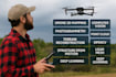
Drone or video input to 3D mesh
SfM + MVS reconstruction pipeline
Point cloud filtering and texturing
Support for LiDAR fusion and mesh cleanup
Output in STL, OBJ, PLY, or GLB
Tags:
From visual data to real-world geometry automated, accurate, and clean.

Q: What resolution is required for drone input?
A: Ideally 1080p+ video or 12MP+ images. Higher resolution improves model quality.
Q: Can you align multiple flights or scenes?
A: Yes, I can align and merge datasets if there’s proper overlap and reference points.
Q: Is the output usable in Unity, Unreal, or CAD?
A: Yes. I can export in GLB, OBJ, STL, or PLY depending on your software needs.
