Ver categorias
Explorar
Fiverr Pro
Português
$
USD

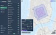


Do you need accurate geospatial analysis or meaningful insights from your spatial data? Youre in the right place.
I am a GIS-focused developer with experience in spatial analysis, data processing, and map creation using Python and professional GIS tools. I help transform raw geographic data into actionable insights and clear visual outputs.
WHAT I CAN DO:
TOOLS & TECHNOLOGIES:
Python (GeoPandas, Shapely, Rasterio), QGIS, ArcGIS, GDAL, PostGIS
WHY CHOOSE ME:
I work with businesses, researchers, and individuals to solve real-world problems using geospatial data.
Feel free to message me before placing an order to discuss your project.
Boston
Idiomas
What types of analysis can you perform?
Buffer analysis, proximity analysis, spatial joins, overlays, heatmaps, clustering, and more.
Can you automate GIS workflows?
Yes, I can build Python scripts to automate repetitive GIS tasks.
What data formats do you support?
CSV, shapefiles, GeoJSON, raster data, and more.
Will I receive the processed data?
Yes, all results (maps and datasets) will be delivered.
Can you explain the results?
Yes, I provide a clear explanation or summary depending on the package.
Do you work with large datasets?
Yes, large and complex projects are handled in the Premium package.


