Ver categorias
Explorar
Fiverr Pro
Português
$
USD

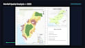


Custom GIS mapping, spatial analysis, reports, presentations, and publication-ready maps with fast delivery and reliable support.
CONTACT ME BEFORE PLACING AN ORDER to discuss your project requirements and receive a custom offer.
Looking for professional GIS maps, map layouts, or spatial analysis for your research, business, or environmental project?
You've come to the right place.
I specialize in creating accurate, visually appealing GIS maps and map layouts using ArcGIS Pro and QGIS. Whether you need publication-quality maps, environmental analysis, remote sensing, or cartographic design, I can deliver professional results tailored to your needs.
Services I Offer
"GIS Analyst and Spatial Analysis Expert"
Idiomas
What data do you need?
Shapefiles, GeoJSON, Excel/CSV, coordinates, KML/KMZ, or simply explain your project.
Can you provide reports and presentations?
Yes. I provide PDF reports, PowerPoint presentations, and project explanations.
Can you handle academic and research projects?
Yes. I create publication-quality maps for research, universities, businesses, and organizations.
Do you offer custom GIS projects? .
Yes. If your project involves multiple maps, advanced GIS analysis, or a unique workflow, simply send me a message. I'll review your requirements and provide a custom offer tailored to your project


