Ver categorias
Explorar
Fiverr Pro
Português
$
USD

Habilidades
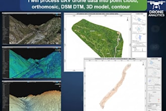
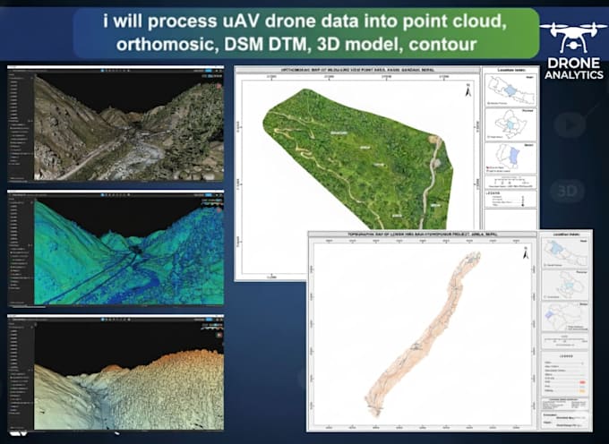
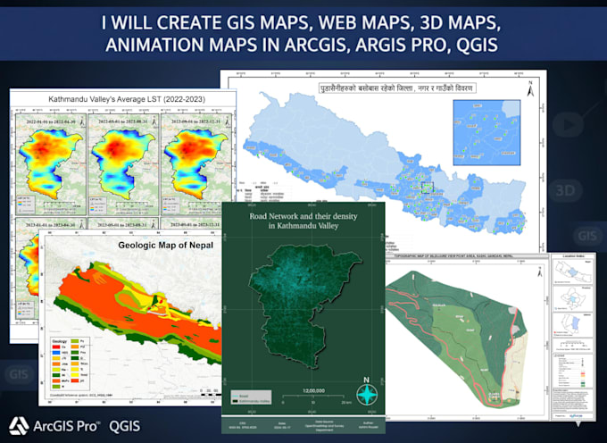
Conheça meus serviços
| (2) | ||
| (0) | ||
| (0) | ||
| (0) | ||
| (0) |
fragle2112
Cliente recorrente

Reino Unido
Fantastic from start to finish, Ashim delivered within QuickTime and great quality of outputs... Would recommend Ashim to anyone and I will definitely use his services again
fragle2112
Cliente recorrente
Reino Unido
Fantastic from start to finish, Ashim delivered within QuickTime and great quality of outputs... Would recommend Ashim to anyone and I will definitely use his services again