Ver categorias
Português
$
USD
Conecte-se à sua IA


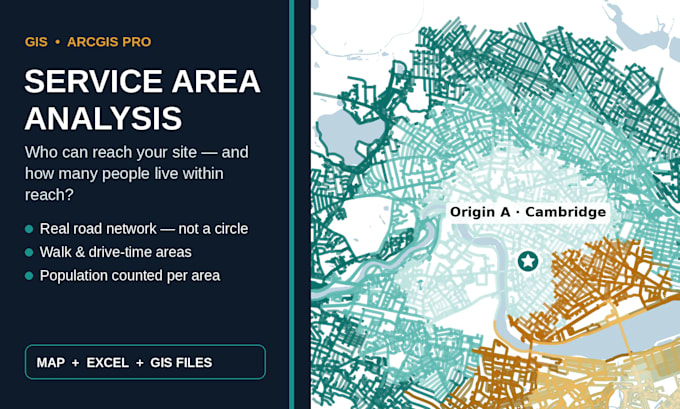
Know exactly who your site can reach, and how many people live within reach.
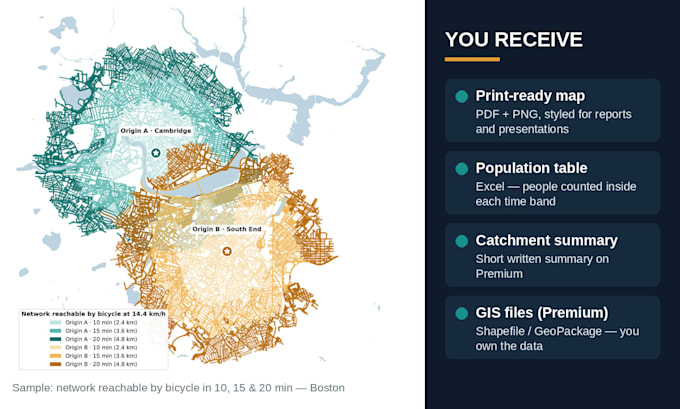
I am a geospatial analyst with an MSc in Geography and Environment. I build service area maps in ArcGIS Pro, Python, and QGIS that show the real walk or drive area around your location, not a simple circle, and I count the population inside each area.
You get:
My own research mapped 15-minute access for 518 city blocks and 981 services, so this is the exact work I do every day. I work in ArcGIS Pro and QGIS. Spatial data and maps you can defend in a meeting or report.
Message me before you order.
Geospatial Analyst and Data annotator
Idiomas
What do you need from me to start?
The address or coordinates of your site, and whether you want walk time, drive time, or both. If you have your own boundary or customer data, you can send that too.
Is this a circle around my location?
No. A service area follows the real road and path network, so it shows where people can actually reach in 5, 10 or 15 minutes and so on.
Where does the population data come from?
From official census and open data for your country or city. I will tell you the source and year in your delivery.
Can you do more than one location?
Yes. The Premium package covers up to 3 locations. Message me for a custom offer if you have more.
What formats do I receive?
Maps in PDF and PNG on all packages, the population table in Excel on Standard and Premium, and the GIS files on Premium.