Parece que este serviço está em espera

I will do image processing and digital mapping using arcgis, erdas

A
amnanaqvi305
A
amnanaqvi305
Naqvi
Algumas informações são exibidas no idioma inglês.

Sobre este Serviço

For GIS users and everyone who needs geospatial data.

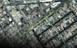
I will do image processing and digital mapping to create a professional map.

I will perform classification (Supervised and Unsupervised) by using ArcGIS and ERDAS IMAGIN.

I can Perform 2D and 3D spatial analysis.

I can perform DIGITIZATION from image visualization, and processing.

High-Quality service.

Please send a message with any questions according to your need.


Conheça mais sobre Naqvi

Naqvi

GIS and Data Visualization Expert

5,0(1)
  • A partir dePaquistão
  • Membro desdejan. de 2023
  • Última entrega1 ano
  • Idiomas

    Inglês, Urdu
Hi, there!! I am a Geographer. GIS and Google Earth expert and Professional Map Maker. I have More than 5 Years of Experience in Geospatial Analysis and GIS. I also have experience in the use of GIS software such as ArcGIS, QGIS, and Erdas Imagin; to develop thematic maps, digitization, vectorization, cartography, spatial database, geo-processing, and everything related to GIS. I’m ready to help you with your GIS reports, and next projects and fulfill your future objectives.