Ver categorias
Português
$
USD
Conecte-se à sua IA
GIS Professional, GIS Consultant, Spatial Analysis , ArcGIS , Web Dasboard
Habilidades
Conheça meus serviços

Sr GIS Specialist
Private • Período integral
Jun 2022 - Present • 4 yrs 5 mos
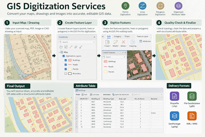
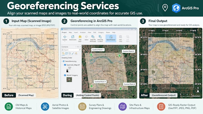
Worked as a Senior GIS Specialist, delivering geospatial analysis, environmental mapping, and spatial data solutions across urban planning, climate resilience, biodiversity, and water management projects. Key responsibilities and achievements: • Developed thematic maps and spatial analyses using ArcGIS Pro, QGIS, and Google Earth Engine. • Conducted remote sensing analyses, including NDVI, NDWI, NDBI, land use/land cover mapping, and DEM-based terrain analysis. • Supported biodiversity assessments, environmental monitoring, and GIS-based decision-making frameworks. • Prepared high-quality maps, spatial datasets, and visualisations for technical reports and client presentations. • Contributed to research and innovation initiatives, technical proposals, EOIs, and RFPs. • Collaborated with multidisciplinary teams and international clients to deliver accurate, reliable, and project-specific geospatial solutions.

GIS Expert
Government Agency • Período integral
Aug 2016 - May 2022 • 5 yrs 9 mos
Worked as a GIS Expert, contributing to urban planning, environmental assessment, climate resilience, and sustainable urban development initiatives. Key responsibilities and achievements: • Developed GIS-based maps and spatial analyses to support urban planning and decision-making. • Conducted satellite imagery analysis, including NDVI, land use/land cover mapping, and urban environmental assessments. • Contributed to GIS-based frameworks for urban waterbody rejuvenation and environmental monitoring. • Processed spatial datasets, satellite imagery, and terrain data using ArcGIS and other geospatial tools. • Prepared thematic maps, technical visualisations, and spatial outputs for reports and presentations. • Supported research, technical documentation, and multidisciplinary projects focused on sustainable and climate-resilient cities.
