Ver categorias
Explorar
Fiverr Pro
Português
$
USD


Tradução automática
Bem-vindo ao WebGIS Hub da Geon!
Quer transformar dados geoespaciais complexos em mapas interativos, responsivos e de alto desempenho na web? Não procure mais!
Sou um desenvolvedor profissional de WebGIS e Geoespacial. Especializo-me em criar aplicações modernas de mapeamento na web, adaptadas às necessidades do seu negócio, garantindo experiências suaves para o usuário e visualização robusta de dados.
O que posso fazer por você:
Minha stack tecnológica:
Por que trabalhar comigo?
IMPORTANTE: Cada projeto de GIS é único. Entre em contato comigo e envie seus requisitos
Esteja atento ao fato que é contra as políticas do prestador da Fiverr incluir temas, modelos ou outros elementos no trabalho entregue que infrinjam os direitos de terceiros ou leis aplicáveis. Leia mais em nosso Guia de Criação Digital Responsável.
WebGIS Developer
Idiomas
Tradução automática
Tradução automática
Quais formatos de dados geoespaciais preciso fornecer?
Você pode fornecer seus dados espaciais em formatos como GeoJSON, Shapefile (zipado SHP), KML/KMZ, CSV (com latitude/longitude), ou me dar acesso ao seu banco PostGIS. Se você ainda não tiver os dados prontos, posso ajudar a encontrar dados geoespaciais de código aberto ou gerar dados de exemplo para seu projeto.
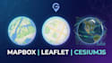
Qual biblioteca de mapeamento devo escolher para meu projeto (Mapbox, Leaflet ou Cesium)?
Depende dos requisitos do seu projeto. Leaflet é excelente para mapas leves, rápidos e simples em 2D. Mapbox GL JS é perfeito para mapas vetoriais altamente personalizados, modernos e de alto desempenho em 2D/3D. Cesium.js é a melhor escolha para visualização pesada de terrenos em 3D, integração com BIM e aplicativos de cidade inteligente.
Preciso pagar pelas chaves de API do Mapbox ou Google Maps?
Você precisará registrar uma conta gratuita no Mapbox ou Google Cloud para obter sua própria chave de API/token de acesso, assim mantém controle total sobre seu aplicativo. Não se preocupe—a maioria dos provedores oferece uma camada gratuita bastante generosa (por exemplo, Mapbox oferece até 50.000 carregamentos de mapas gratuitos por mês), o que geralmente é mais do que suficiente.
Você pode integrar o mapa na web ao meu site existente?
Sim, com certeza! Posso criar a aplicação WebGIS como uma plataforma independente ou integrá-la perfeitamente ao seu site existente, seja ele feito com React, Vue, HTML/JS puro ou até WordPress. Por favor, envie uma mensagem para discutir sua stack tecnológica atual antes de fazer o pedido.


